 In mid-July 2011, our Executive Director, Rick Crouthamel, accompanied by a fellow Rotarian, Anthony Clarke, traveled throughout “The Warm Heart of Africa,” for ten days. They gathered information about the historic environmental data needs of the Malawian people and met with officials from the Malawi Department of Climate Change and Meteorological Services.
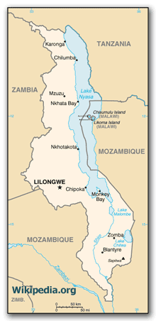
The Republic of Malawi is one of IEDRO’s first data rescue and digitization (DR&D) cooperating countries. Nearly 14 million people inhabit a narrow strip of land of about 45,000 square miles (about the size of Pennsylvania). The country is nestled between three other DR&D cooperating countries – Zambia to the northwest, Tanzania to the northeast and Mozambique on the remaining sides. Lake Malawi, sometimes called the Calendar Lake as it is about 365 miles long and 52 miles wide (Wikipedia), forms most of its eastern border.
Malawi is one of the poorest countries in the world with a Gross Domestic Product of less than $350/person. Other than HIV, water-borne diseases are the most significant public health problem. Diseases such as malaria, yellow fever, hepatitis and amoebic dysentery are among the most common. These diseases are promulgated through a lack of potable water supplies with many villagers walking 2-3 km to drink from polluted sources. Standing water during the lengthy rainy season provides breeding areas for mosquitoes and acts as a conduit to spread diseases. Thus, the management of water resources is important to the improvement of the standard of living of all Malawians.
Bore Hole Project: The first part of the trip focused on the water needs of the Malawians. As part of a Rotary International effort, Rick and Anthony visited a school in Nkhamenya, northern part of the country where donations funded the drilling of a well.
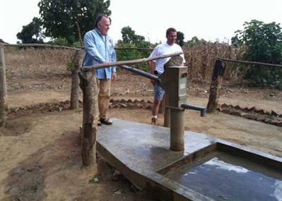
The project provided a safe and consistent water supply to over 700 school children who heretofore had to walk 2-3 km to get a drink from a polluted pond. Providing a drilled well assisted the area with responsible water management by not only giving the residents a safe source of drinking water, it also encouraged the Malawians to drain their former drinking water sources – the non-potable, mosquito-laden ponds. The hope of the project was to help stem the spread of insect-borne diseases that affect the region. As there is little or no rain from May through October the residents had to depend on a water supply even though it was polluted.
Data Rescue and Digitization: The first step is to understand what water resources exist now and what water resources will likely be needed during the next five to ten years. This analysis should be based on a complete analysis of precipitation that has occurred over the past few hundred years, including the amounts, the intensities, the durations and the trends. Unfortunately, although these data are available at the Malawi Department of Climate Change and Meteorological Services, they are not usable in their present form.
Detailed records, which are ink traces on analog charts called “strip charts,” graphically show the precipitation characteristics, including amount, rate, intensity and duration.
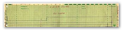
Strip chart
To extract the detailed precipitation information from these charts manually, an experienced technician would have to spend at least 30 minutes on each chart. Considering that Malawi has least 20,000 – 30,000 of these charts to be digitized, another method had to be found. IEDRO over the past three years, using Malawi precipitation charts as a base, has developed a software program that will in seconds take the scanned images of these charts and digitize the data at 5 minute intervals (288 values per day) and do so more accurately.
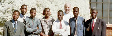
Left to right: Donald Kamdonyo, Dir, National Meteorological Society; Martin Munkhanya, IEDRO volunteer; the meteorological society volunteer staff and behind, Ken Clark, NOAA/NWS employee
Keying of Alpha-Numeric Data: A start-up project will be developed at IEDRO Headquarters in Deale, MD to establish a prototype for additional keying facilities. Once programming and processes are established, we will locate operations in Malawi under the management of the Malawi Department of Climate Change and Meteorological Services. The Service would provide the facility, power, and security.
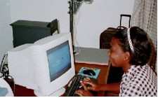
One of the photo digitizing work areas in Malawi.
IEDRO will provide equipment and training for the Malawi keying facility to scan hydrometeorological strip charts and enter the metadata, first for all Malawi charts, and then for other southern African countries. The scanned images would be sent on DVDs to IEDRO Headquarters for digitization and returned to the countries of origin.