Projects & Programs
Reaching out to help find and rescue valuable environmental data at risk of loss
How we work
Successfully rescuing historic environmental data requires collaboration at each step. Data owners typically play a pivotal role in identifying historic data at risk. They also are needed to assist in inventorying what was measured, when, where and how often. This typically requires a site visit by IEDRO experts to work with the data owner to fully define the potential scope and feasibility of the work. This in turn allows IEDRO’s data experts to reach out to its contacts at various data archives to confirm which of those records remain unavailable in digital form. With the scope of the opportunity known, attentions can shift to lining up collaborators for financial support and crafting a plan for execution that includes imaging the fragile records and digitizing their contents. It sounds straightforward but it’s not.
Current Projects
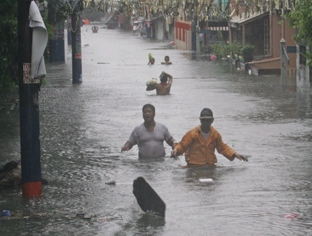
Panama
The Panama Canal relies on rainwater to function. Store too little and ships in the dry season must come through partially loaded. Let too much flow through in the rainy season and the overwash can damage the locks. IEDRO has 15,000 images of hourly precipitation on microfilm spanning from 1907 to the 1970’s that once digitized can help managers keep this vital shipping lane moving food and other goods.
Bolivia
Working with SENHAMI, Bolivia’s hydrometeorological agency, IEDRO has some 16,000 images of daily records from 22 weather stations awaiting digitization. IEDRO has been using the images to refine its Weather Wizards tool that empowers citizens to key in data that is then quality assured and ready for use by Bolivian specialists. The data would also be publicly available for use in climate change forecasting, weather modeling, and other critical tools critical to mitigating the disasters that lie ahead.
Uzbekistan
Water is critical to this country for among other things its hydroelectric power. Uzhydromet, the country’s hydrometeorological agency, has records extending back to 1867, providing critical insights for its agriculture, power stations, gas and oil industries, transportation, communication, civil engineering, urban development, and tourism, not to mention its value for understanding what global warming will bring.
Over the years, IEDRO has worked with dozens of countries. In some cases these outreaches have led to training sessions. In others, funding and interests have allowed full blown collaborations with onsite visits, inventorying of valuable records, imaging, and digitization. These larger projects have included Tanzania, Chile, and Dominican Republic.
Saving Data
Listed below are some of our collaborations.
Country | Begun | Stopped | Update | Data Rescued | Digitized | Pages | Remarks |
| Albania | |||||||
| Angola | 2020 | 2021 | Excel training | ||||
| Bangladesh | |||||||
| 2011 | 2015 | 1 | 15K images received but images poor quality | ||||
| 2004 | 2007 | SFC | Yes, by NOAA | 504K imaged | |||
| 2009 | 2011 | 1 | |||||
| El Salvador | 2009 | 2011 | Pluviograms | 3600 scanned & digitized by Weather Wizards | |||
| Gambia | |||||||
| Kenya | 2005 | 2008 | U/A | Radiosonds | |||
| Malawi | 2003/2011 | 2007/2018 | U/A | Radiosondes and 30K Pluviograms | |||
| Mali | 2005 | 2008 | U/A | Radiosonds | |||
| Mauritius | |||||||
| Mozambique | 2005 | 2008 | U/A | Radiosonds | |||
| Nicaragua | 2009 | 2010 | Located pluviograms but no funding | ||||
| Niger | 2005 | 2008 | U/A | Radiosonds | |||
| Niger (ACMAD) | SFC | 2 million microfiche, 250,000 scanned, [corruption?] | |||||
Panama | 2023 | 1 | |||||
| Paraguay | 2009 | 2010 | 2010 | early scoping and building contacts | |||
| Saudi Arabia | 2001 | basic visit | |||||
| Senegal | 2005 | 2008 | 2010 | U/A | Radiosonds | ||
| Sierra Leone | |||||||
| Taiwan | |||||||
| 2008 | 2010 | U/A | 1 | PIBALS | |||
| Uruguay | 2004 | 2007 | |||||
| 2014 | 2020 | 2020 | Surface | no | 1 | KMA funded, 7 of 17 million imaged, Excel training added | |
| Zambia | 2005 | 2008 | U/A | Radiosonde and PIBAL | |||
| Zimbabwe |